A Framework for a Subwatershed-Scale Screening Tool to Support Development of Resiliency Solutions and Flood Protection Priority Areas in a Low-Lying Coastal Community

Abstract
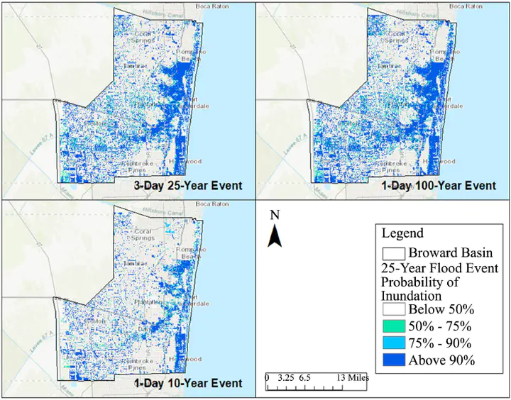
Flood risk analysis is the instrument for local officials to create a sound strategy and adaptation plans for the impacts of inundation due to heavy rains, climate change and sea level rise. Hence, cities with aging infrastructure are retrofitting their stormwater management systems to mitigate the impacts. However determining the most at risk areas and the options for corrections is more challenging. As a result, there is an urgent need to develop a screening tool to analyze watersheds and identify the most at-risk areas. High-quality, open source data and sophisticated spatial analysis techniques allow engineers to create innovative ways to conduct watershed wide inundation analysis. In this study, the investigators developed a screening tool to identify at-risk properties by combining readily available data on topography, groundwater, surface water, tidal information for coastal communities, soils, open space, and rainfall data. Once the screening tool is developed, the means to identify and prioritize improvements to be funded with scarce capital funds is the next step. A tool box of solutions was developed to address flood risk and vulnerability. Testing of the screening tool was conducted in Broward County, Florida and shows encouraging results. Comparison with FEMA Flood maps and repetitive loss mapping indicates that the process works in a coastal community. The framework appears to be viable across cities that may be inundated with water due to sea-level rise, rainfall, runoff upstream, and other natural events.