Establishing a Framework of a Watershed-Wide Screening Tool to Support the Development of Watershed-Based Flood Protection Plans for Low-Lying Coastal Communities
Abstract
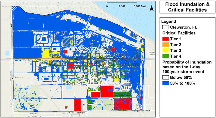
Flood risk analysis is the instrument by which floodplain and stormwater utility managers create strategic adaptation plans to reduce the likelihood of flood damages in their communities, but there is a need to develop a screening tool to analyze watersheds and identify areas that should be targeted and prioritized for mitigation measures. The authors developed a screening tool that combines readily available data on topography, groundwater, surface water, tidal information for coastal communities, soils, land use, and precipitation data. Using the outputs of the screening tool for various design storms, a means to identify and prioritize improvements to be funded with scarce capital funds was developed, which combines the likelihood of flooding from the screening tool with a consequence of flooding assessment based on land use and parcel size. This framework appears to be viable across cities that may be inundated with water due to sea-level rise, rainfall, runoff upstream, and other natural events. The framework was applied to two communities using the 1-day 100-year storm event – one in southeast Broward County with an existing capital plan and one inland community with no capital plan.