Downscaling a Flood Risk Screening Tool at the Watershed, Subwatershed, and Municipal Levels
Abstract
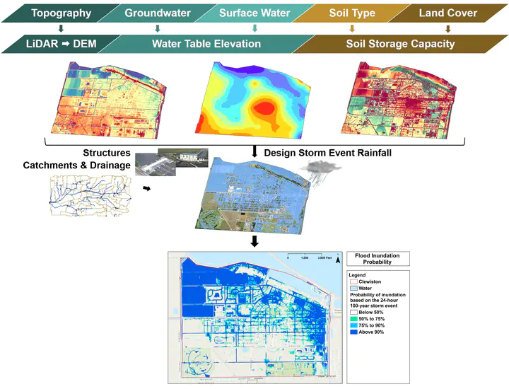
This research aims to develop a large-scale locally relevant flood risk screening tool, that is, one capable of generating accurate probabilistic inundation maps quickly while still detecting localized nuisance-destructive flood potential. The CASCADE 2001 routing model is integrated with GIS to compare the predicted flood response to heavy rains at the watershed, subwatershed, and municipal levels. Therefore, the objective is to evaluate the impact of scale for determining flood risk in a community. The findings indicate that a watershed-level analysis captures most flooding. However, the flood prediction improves to match existing FEMA flood maps as drill-down occurs at the subwatershed and municipal scales. The drill-down modeling solution presented in this study provides the necessary degree of local relevance for excellent detection in developed areas because of the downscaling techniques and local infrastructure. This validated model framework supports the development and prioritization of protection plans that address flood resilience in the context of watershed master planning and the Community Rating System.